
Sabattus Mountain
The Property
Owned by State of Maine Bureau of Parks and Lands (BPL), this 177 acre property features one of the most popular hiking trails in southern Oxford County and offers panoramic views of the White Mountains and Kezar River Valley. The land has a longstanding history of public use by hikers and hunters, but was not conserved until the late 1980s when BPL used the Land for Maine’s Future program to purchase the property. Greater Lovell Land Trust jointly manages the property through an agreement with BPL.
The 1.3 mile loop trail begins from the parking lot then the trail splits a short distance into the woods. Either path will lead to the summit of 1,253-foot Sabattus Mountain. Turning right is the traditional way to ascend the mountain, as this side of the loop has fewer inclines. However, while these inclines are shorter, they are more strenuous than those fund on the left side of the loop. Either way you go, the trail up Sabattus Mountain is moderately strenuous with some steep sections that climb exposed ledge. You will also encounter plenty of roots and rocks along this trail, so watch your feet!
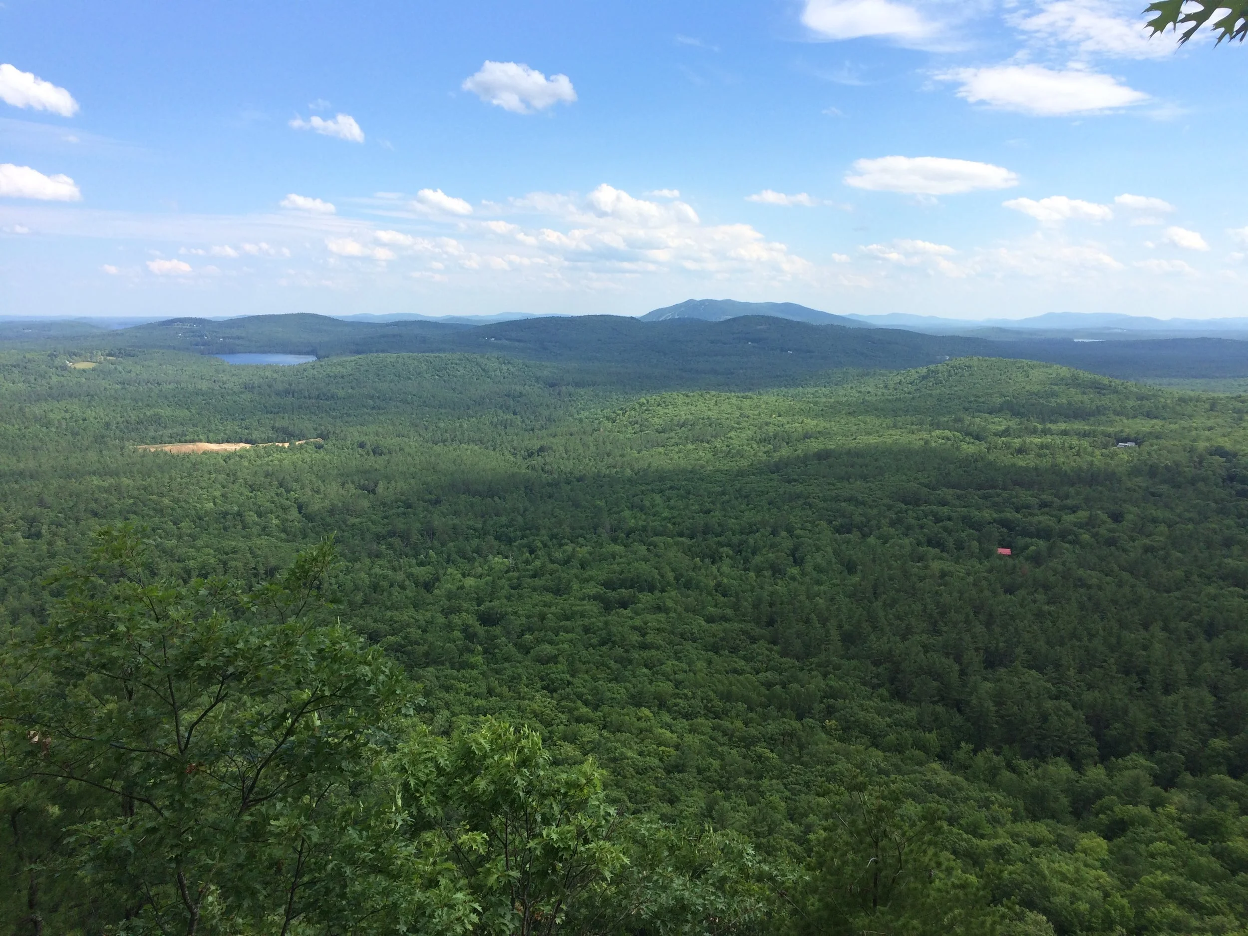
Once at the summit, the southwest side provides several overlooks along immense cliffs that provide outstanding views where one can enjoy a picnic lunch, watch hawks glide in the thermals, or just soak in the breathtaking views. At the summit, one can see Keyes Pond, Kezar Lake, the ski trails on Pleasant Mountain, and the White Mountains. The overlooks also provide an excellent area to view the spectacular fall colors with sweeping views of the surrounding countryside. Much of the view is protected through conservation easements, and the efforts of the GLLT and others.
Other Information
Although the trails are a moderate hike, please be aware that the summit has some vertical cliffs and caution should be used at these lookout points. The parcel is open to hunting and hikers should wear blaze orange when hiking from October through December. Hunters are reminded that discharging a firearm within 300 feet of a trail is prohibited on BPL lands.
Directions: From Lovell Village (GLLT office at 208 Main Street), drive North on Route 5 for about 4.5 miles. Make a right onto Sabattus Road. Follow Sabattus Road for about 1.5 miles. Keep right to continue onto Sabattus Trail Road (a small dirt road) and follow for close to a mile. The trailhead will be on your right. Note: The Maine DOT maintains large directional signs for Sabattus Mountain on Route 5 and Sabattus Trail Road. There is no directional sign telling you to turn onto Sabattus Trail Road from Sabattus Road, so pay attention to street signs once on Sabattus Road.

Activity Guidelines
Sabattus Mountain is open to public from dawn to dusk. Because Sabattus Mountain is owned by BPL, it is subject to their rules and regulations for state parks and historic sites. These rules can be found here, with some key points summarized below.
Hiking
Hunting in accordance with Maine Law & BPL regulations
Snowshoeing
Cross-country skiing
These activities are not allowed:
Motorized vehicles
Cutting and removal of vegetation
Camping and campfires
Unleashed pets